


Track and time this hike using a mobile device!
TRACK AND TIME YOUR HIKE
Sea to Summit Trail
 Directions to the Sea to Summit Trail
 Download offline KML trail map of Sea to Summit Trail

Stawamus Chief Provincial Park, Squamish
49.671544, -123.158865
8°c Light Rain Humidity: 96% Sunrise: 5:56 am
Track and hike this trail on your mobile device!
Total Distance
(One Direction)
(One Direction)
Total Ascent

Elevation Profile
Trail Description
Once considered the Upper Shannon Falls trail, the Sea to Summit now extends significantly farther up the mountain, ultimately ending at the recently built Sea to Sky Gondola summit lodge.
The Sea to Summit trail starts between the Sea to Sky Gondola and Shannon Waterfall parking lots. Follow the very visible and frequent trail markers labelled 1 through 400. The first 68 markers follow the very steep, Grouse Grind comparable Stawamus Chief trail before branching off to the right.
Once on the Sea to Summit trail, the terrain varies from vertical rope-assisted rock climbing, dense forest, exposed bush areas and gravel service road. While briefly challenging at times, overall the trail offers a decent balance of environments and is fairly pleasant.
Once on the top, you can purchase a download ticket on the Sea to Sky Gondola ($15 per ticket as of Summer 2018)
Photos of the Sea to Summit Trail (9)


 Add your own photos
matthew.inouye
Jul 22nd 2018
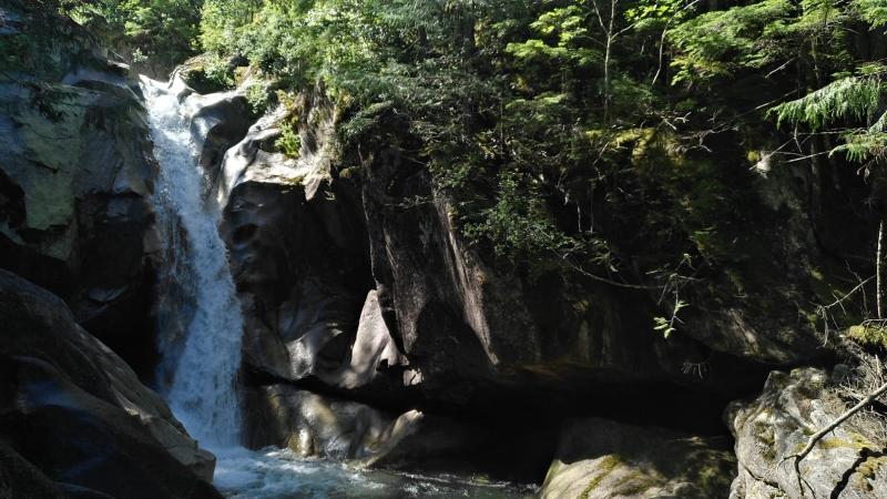
Lukas Falls
matthew.inouye
Jul 22nd 2018
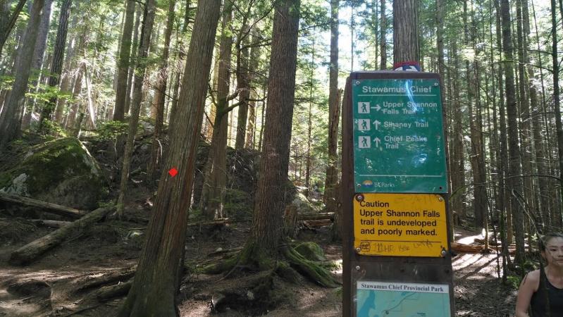
Turn right to the Upper Shannon Falls trail
Look for Marker #68 and turn right
matthew.inouye
Jul 22nd 2018
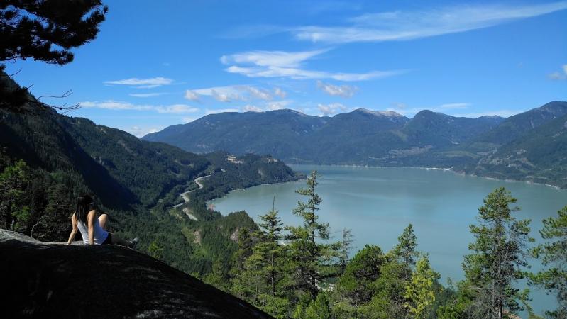
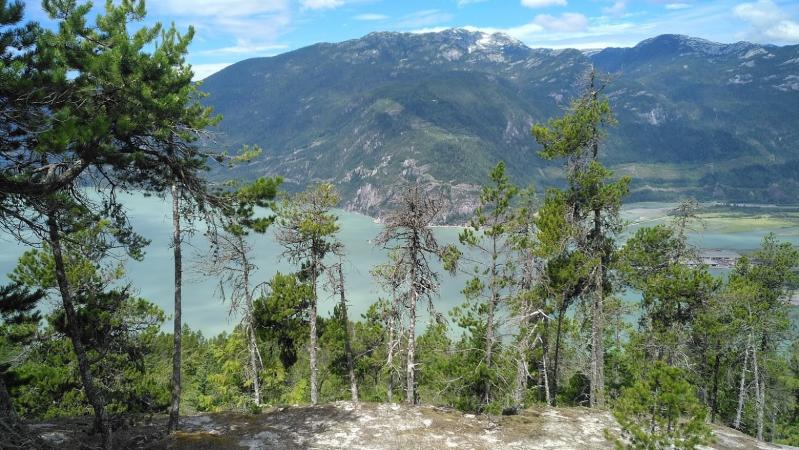
View of Howe Sound and Highway 99
The viewpoint is unmarked. Right after you re-enter the forest following the clearing under the Gondola, look for a large boulder on the right and climb up.
matthew.inouye
Jul 22nd 2018
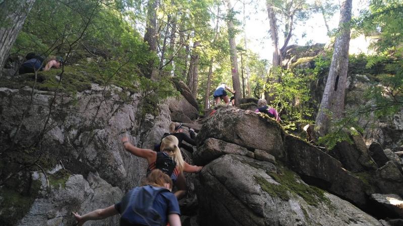
Climbing over and between large rocks
matthew.inouye
Jul 22nd 2018
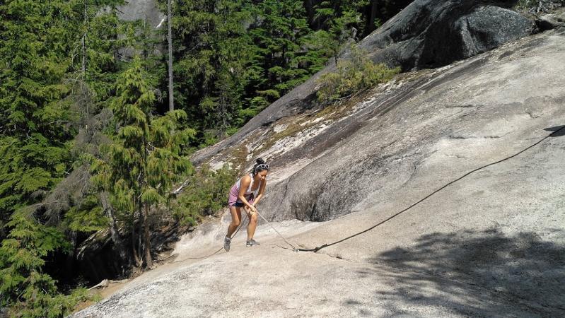
Rope climbing
matthew.inouye
Jul 22nd 2018
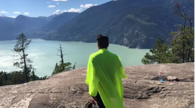
Exposed area to rest and catch a view
yukiandbee
May 25th 2019
Summer 18
yukiandbee
May 25th 2019
The end of the Hike
yukiandbee
May 25th 2019
The end of the Hike
Tags
Download Free KML Trail Map for the Sea to Summit Trail
 The Sea to Summit Trail is equipped with a free downloadable offline trail map that can used in Google Earth, Google Maps/KML enabled cell-phone or in a GPS device.
Download KML trail map
The Sea to Summit Trail is equipped with a free downloadable offline trail map that can used in Google Earth, Google Maps/KML enabled cell-phone or in a GPS device.
Download KML trail map
Trails near the Sea to Summit Trail
Stawamus Chief First Peak 80 meters away
Stawamus Chief Second Peak 80 meters away
Stawamus Chief Third Peak 80 meters away
Sea to Sky Trail First Leg 1.4 km away
Deeks Lake Trail 15.3 km away
Top Trail Times
| # | Hiker | Date | Start Time | Duration |
| 1 | Felix Tavira | Jun 2, 2018 | 08:35:09 | 02:45:00 |
| 2 | Matthew Inouye | Jul 21, 2018 | 09:48:13 | 02:55:54 |
| 3 | Yuen Chow | Jul 21, 2018 | 09:48:03 | 03:02:53 |
| 4 | Felix Tavira | Aug 10, 2020 | 11:51:02 | 03:40:04 |
Comments
